Give your feedback on St Anne Street junction plans
Cheshire West and Chester Council has been awarded grant funding from Active Travel England to improve the crossing facilities for walking, wheeling and cycling at the St Anne Street and St Oswald’s Way junction. New traffic signals will also improve the traffic flows through the junction.
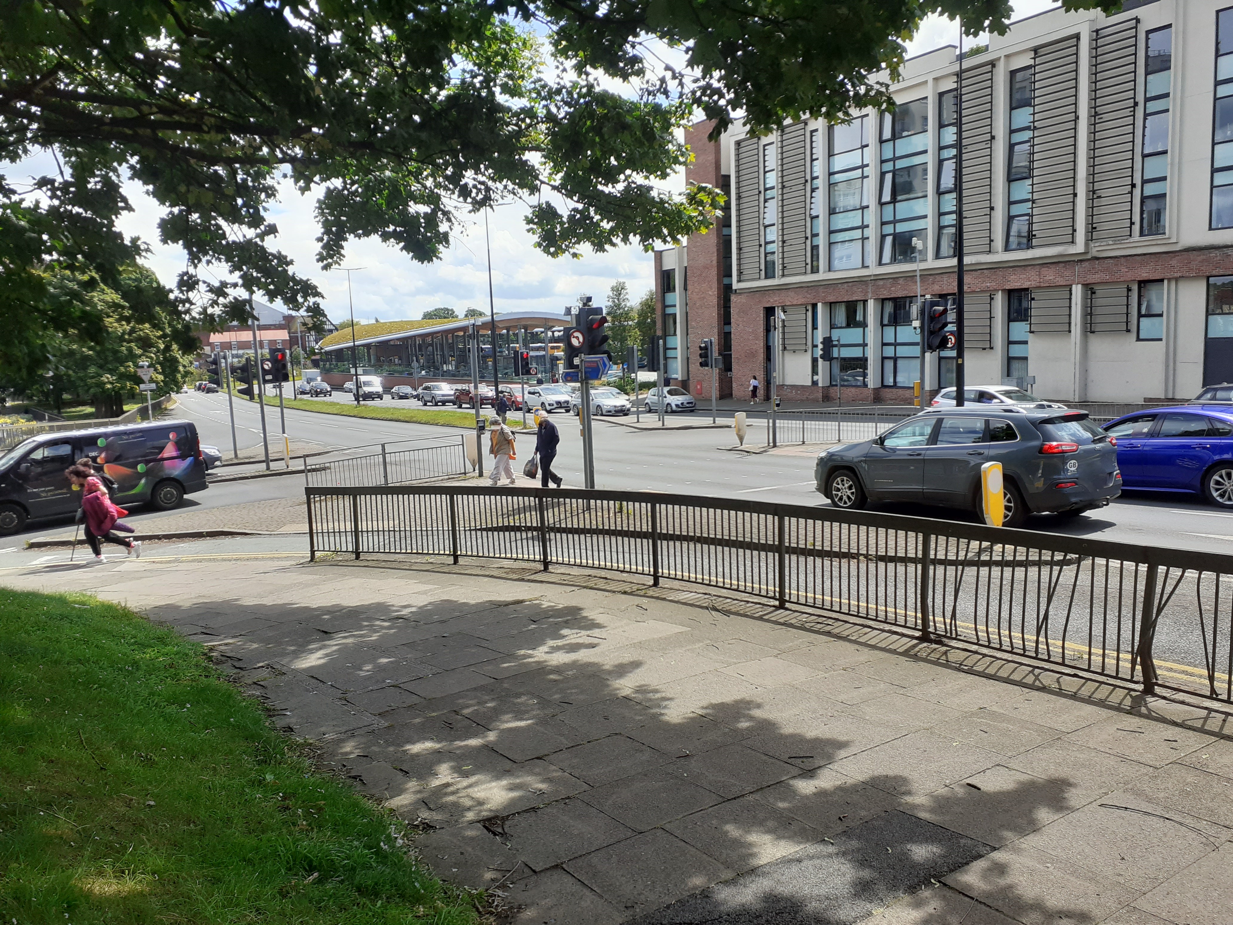
The Council is asking local people, businesses and other stakeholders for their feedback on the proposals, which include separate cycle and pedestrian crossings at the junction, new pedestrian crossings to the Bus Interchange and the widening of the existing cycle track from the junction with Victoria Road.
Plans for the improvements are available for view and comment on the Council’s website. The plans will also be available to see at Northgate Arena.
The Active Travel England grant of £407,000 also includes commissioning ‘Living Streets’ to carry out an engagement project with two secondary schools and 12 primary schools in the borough and compile a list of potential schools for ‘School Streets’ projects, where roads are closed during specific drop-off and pick-up times to keep pupils safer.
The Council’s Deputy Leader Councillor Karen Shore said: “Following discussions with Active Travel England, it is decided that the Council should put forward the construction of the junction upgrade at St Oswald’s Way and St Anne Street in Chester – this junction forms part of the Pink Route within Chester’s coloured cycle network.
“Our Road Safety Team has highlighted this junction as a concern due to the number of road traffic collisions. It provides an active travel connection to the rail station, Chester Bus Interchange and Chester city centre. The design for this scheme has started and is being developed by the Council’s Highway team.“
John Violet, Chester Cycling Campaign, said: “Chester Cycling Campaign is particularly pleased to hear that funding for the work has been granted since cyclists from the Greenway and surrounding area frequently use this crossing.
“The junction forms an important crossing of the Inner Ring Road for both cyclists and walkers but has needed improvement for many years. Improving the quality of the infrastructure will undoubtably increase usage for Active Travel into the city centre.”
Construction is scheduled for completion by March 2025.

A stated objective of the scheme is to “to provide a safer route to get to Chester Bus Interchange”. However, for cyclists, the route to the bus station from the North (and vice versa) is currently inconvenient, and remains so under the proposal. The comments that follow relate to the use of the crossing by cyclists.
The proposed widening of the cycle track is to be applauded, but consideration should be given to the current junction at the Victoria Road end. Cyclists exiting onto Victoria Road are in danger from motorists leaving St Oswald’s Way around the swept corner, usually at some speed, while they at the same time need to monitor traffic approaching from Victoria Road; traffic which also, while queueing to enter St Oswald’s Way, frequently blocks the exit. Cyclists generally enter Victoria Road diagonally (briefly cycling in the opposite sense on the easterly carriageway). This desperately needs to be improved, but no specific measures are described in the proposal.
When arriving via Victoria Road on the (to be widened) cycle track, heading towards the bus interchange and perhaps onwards towards Frodsham Street and the city centre, the desire line is that of the first (more westerly) proposed pedestrian crossing, rather than the designated cycle route, which involves doubling back along the central island before crossing the second half of St Oswald’s Way.
In contrast, the (presumably expected) route via St Anne Street towards the city centre involves a relatively steep ascent as well as a difficult (unassisted) navigation of Delamere Street and/or George Street. In the opposite direction an approach from Gorse Stacks/Delamere Street is not possible due to the one way constraint, and via Delamere Street directly also inconvenient, with much interaction with motor traffic.
This is, of course, the current arrangement – one that suffers from the fact of the beg buttons on the two crossings being (apparently) unsynchronised. Is it to be the case that the button-controlled lights across the two halves of St Oswald’s Way are to be synchronised? For pedestrians and cyclists alike it is a perennial annoyance to be forced to wait a second time in a central island. Furthermore, navigation of the elongated central island involves two right angle turns, potentially placing cyclists such that they are not at the best angle to monitor oncoming traffic, as well as being inconvenient for users of non-standard bicycles, and for those with mobility constraints.
It may be pointed out that the obvious route for cyclists as described above (via the bus interchange and Gorse Stacks) necessarily involves use of a stretch of pavement along the southern side of St Oswald’s Way. This should be legitimised by virtue of a dedicated cycle track or, at worst, designation of the pavement as shared use. There is also scope for improvement of the traversal of the bus interchange via Oulton Place.
My prediction of the use of the proposed scheme by cyclists is that the designated cycle crossing will be ignored in favour of use of the more westerly pedestrian crossing (when approaching from the cycle track) and the more easterly (when approaching along St Anne Street from the direction of the station). Similar comments apply to journeys in the opposite directions. This would be a shame, not only because it would imply wasted expenditure, but also because cyclists and pedestrians would be placed in conflict – one of the very aims is the entire proposal is presumed to achieve.
Here’s an alternative:
1. install Toucan crossings (or parallel cycle/pedestrian crossings) across both sides of St Oswald’s Way – at the two proposed (central and southeast) locations parallel to St Anne Street.
2. Remove the existing crossing at the northwestern end of the elongated island, and truncate that island to a size appropriate for traversal solely perpendicular to St Oswald’s Way.
3. Provide a legal route for cyclists between Oulton Place and St Anne Street along the south side of St Oswald’s Way.
It is my belief that, not only would this provide a preferable solution, but also that it would be more cost-effective.